Keep tropical posts visually aligned with your existing ClearWarn alert system.
National Hurricane Center coverage
Tropical alerts, ready for your audience.
ClearWarn processes National Hurricane Center tropical weather outlooks and advisories, then turns them into clear, audience-ready posts and visuals.
Outlooks
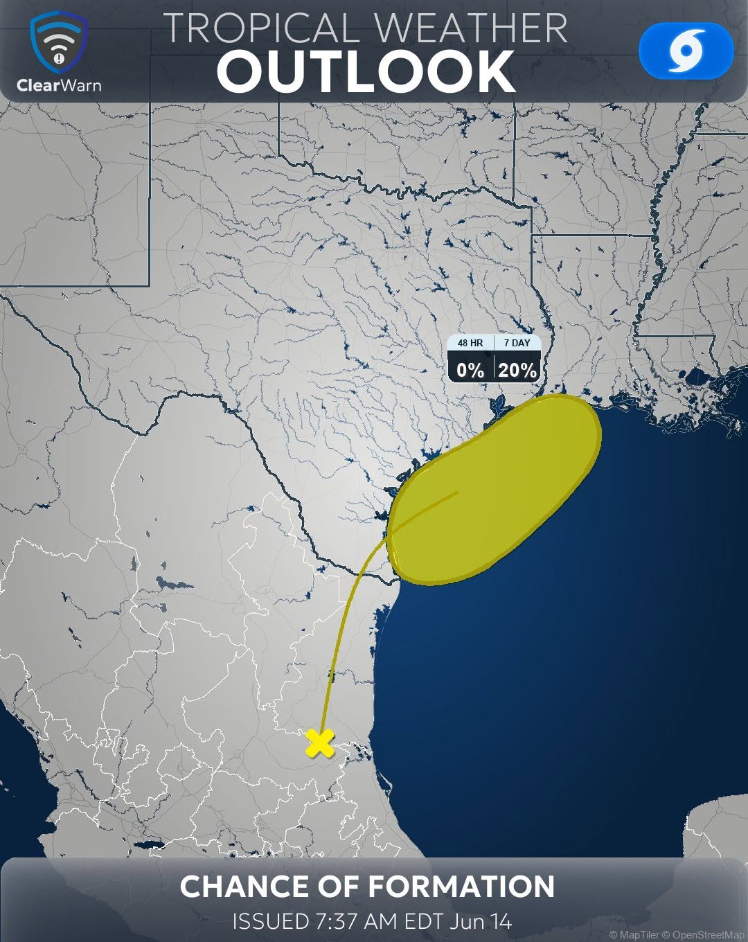
Tropical Weather Outlooks with development risk context
Advisories
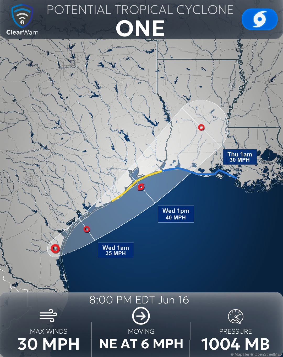
Storm advisories with position, motion, wind, surge, and rainfall impacts
Visuals
Forecast cones and outlook percentage maps for faster scanning
Advisories with forecast cones
Tropical weather outlooks with percentage maps
Tropical alerts posted before others catch up.
Before other media outlets are even aware of new tropical alerts, ClearWarn processes and posts. While others are manually creating imagery, ClearWarn has already posted high quality images and summaries on your behalf.
Use different SmartLayouts for outlooks, advisories, storm updates, and high-impact tropical products.
SmartLayouts for tropical alerts
Tropical alerts that match every other ClearWarn post.
SmartLayouts can be applied to tropical weather outlooks and advisories the same way they are applied to every other alert type.
That means your tropical graphics can use the same fonts, colors, logo placement, sponsor areas, image treatments, and brand rules as your tornado, flood, heat, winter, and severe thunderstorm alerts.
From NHC products to clear guidance
Make tropical information easier to understand.
NHC products are authoritative, but they can be dense. ClearWarn turns those products into clear text that explains what changed, where the system is headed, and what impacts matter.
Images can include storm forecast cones and outlook percentage maps, giving your audience a visual summary that is easier to scan and share.
Summarize areas to watch, development odds, timing, and where future impacts may become more likely.
Translate advisory details into direct updates about track, intensity, rainfall, surge, wind, and timing.
Pair generated text with tropical images built for your brand and your audience.