1
Detect
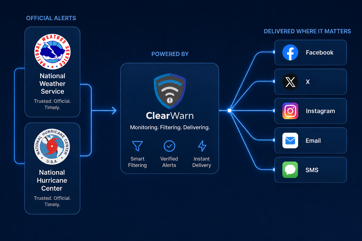
ClearWarn monitors official NWS and NHC feeds continuously for your service area.
You choose which alert types and areas to monitor. Alerts are detected and processed within seconds.
ClearWarn turns official government alerts into audience-ready weather communication across social and broadcast workflows in seconds.
BULLETIN - EAS ACTIVATION REQUESTED Severe Thunderstorm Warning National Weather Service Glasgow MT 729 PM MDT Wed May 13 2026 The National Weather Service in Glasgow has issued a * Severe Thunderstorm Warning for... Central Valley County in northeastern Montana... Western Phillips County in north central Montana... * Until 830 PM MDT. * At 729 PM MDT, a severe thunderstorm was located near Hinsdale, moving east at 40 mph. HAZARD...70 mph wind gusts and quarter size hail. SOURCE...Radar indicated. IMPACT...Expect considerable tree damage. Damage to roofs, siding, and outbuildings is possible. * Locations impacted include... Glasgow, Malta, Hinsdale, and Nashua.
The National Weather Service and National Hurricane Center issue trusted warnings. ClearWarn transforms that source material into clear local guidance with the right timing, tone, action, and channel for your audience.
Designed for the speed of severe weather, but calm enough for everyday operations.
ClearWarn monitors official NWS and NHC feeds continuously for your service area.
You choose which alert types and areas to monitor. Alerts are detected and processed within seconds.
Alerts are rewritten with local context, brand voice, audience type, and clear calls to action.
Images are created with your design. Logo, colors, and any sponsored content can be integrated.
Messages and graphics are published across the channels you configure within seconds.
Facebook, X, Instagram, and more.
Station-branded posts go out while the weather team stays focused on live coverage.

Parent-ready updates for dismissal, athletics, sheltering, heat, and lightning.

Operational notices for guests, employees, customers, and venue teams.
Get important weather information to the public quickly and efficiently.
ATLAS, the Atmospheric Translation, Localization, & Augmentation System, turns raw weather and climate data into cohesive text and visuals.
It understands the hazard, local places, nearby roads, and your audience, then presents the message in your voice so alerts feel clear, useful, and trusted.

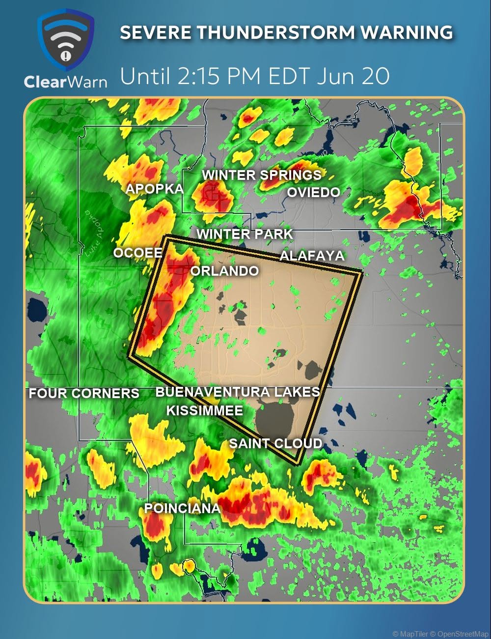
ClearWarn SmartLayouts let you control how alert images look before they ever publish: logos, colors, map framing, radar treatment, typography, sponsor space, and station or organization identity.
The result is alert imagery that feels like it belongs to your newsroom, school, business, or emergency team instead of a generic template.
You design your SmartLayouts right in your browser. Fonts, colors, sizes, images, all easily designed with a drag and drop editor that feels natural.
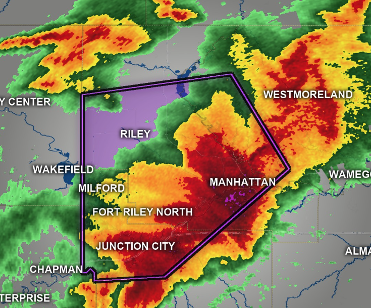
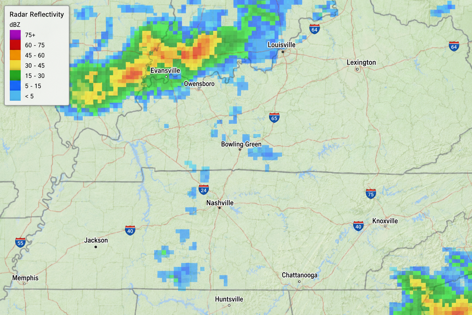
ClearWarn features high-resolution NEXRAD Level 2 radar on alert images, giving your audience a sharper view of storm structure, warning context, and local impact than generic broad-area radar composites.
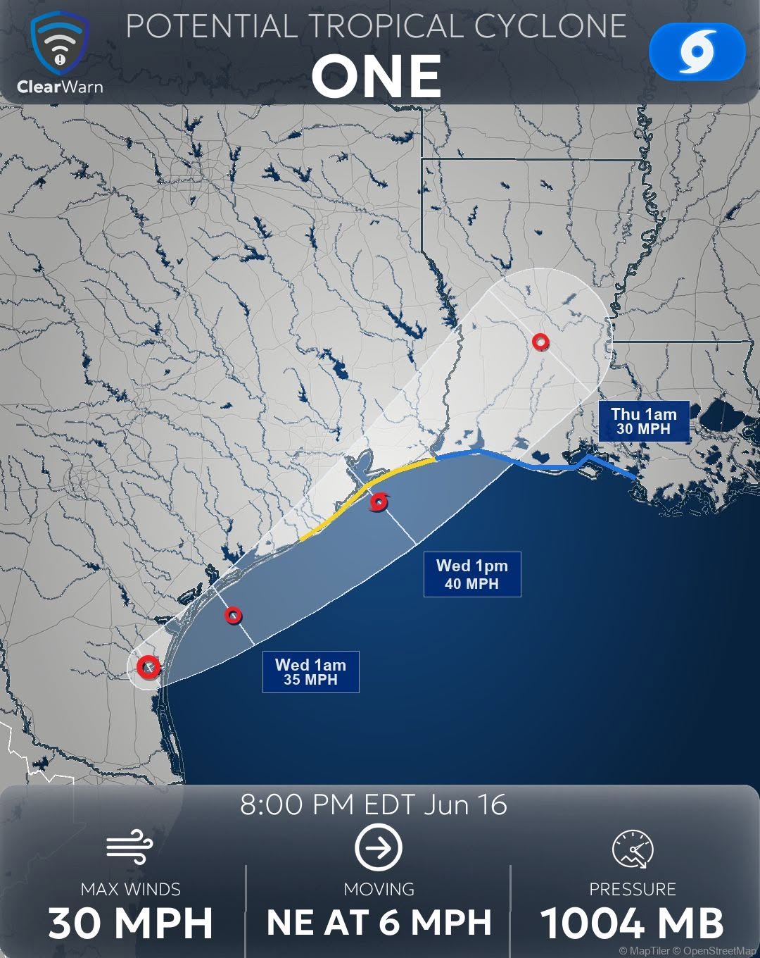
ClearWarn pulls in tropical weather outlooks and tropical advisories from the National Hurricane Center for both the Atlantic and Pacific basins.
ATLAS turns those official products into customizable text and images, helping viewers understand development areas, storm tracks, advisories, impacts, and what to watch next.
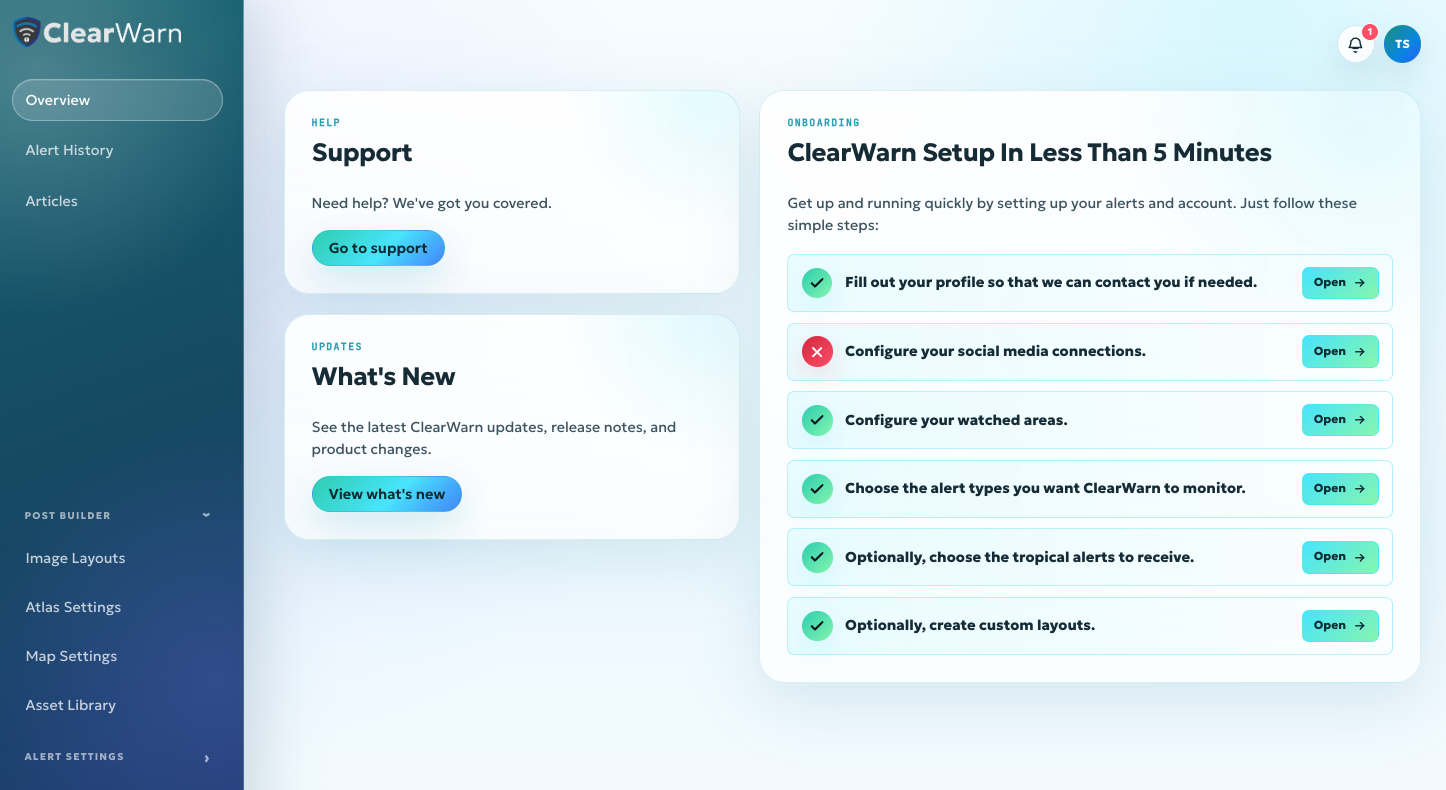
The ClearWarn dashboard gives you complete visibility into your weather alerts and communications. Configure watch areas, alert types, and where your alerts get published.
Configure your SmartLayouts, ATLAS settings, see alert activity, and much more. Everything is intuitive and easy to use right from your browser.
ClearWarn monitors and routes the weather threats your audience needs to understand quickly, from immediate warnings to longer-duration watches and advisories.
You choose which alert types and areas to monitor. Alerts are detected and processed within seconds.
Warnings, watches, shelter guidance, and urgent location-based updates.
Damaging wind, hail, lightning, and severe thunderstorm warnings.
Tropical storm, hurricane, surge, evacuation, and preparedness messaging.
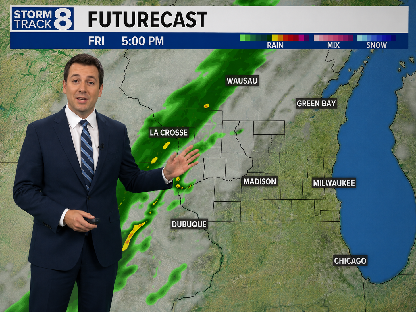
Flash flood warnings, river flooding, coastal flooding, and road impacts.
Snow, ice, blizzard, wind chill, freeze, and travel hazard alerts.
Extreme heat, poor air quality, smoke, and health-focused guidance.
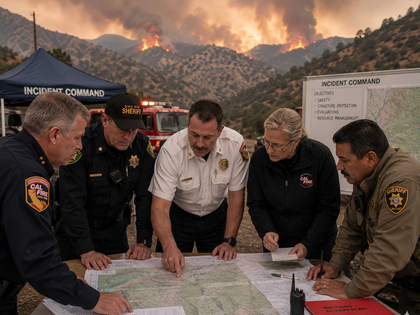
Red flag warnings, high wind, low humidity, and wildfire risk messaging.
High surf, rip currents, gale warnings, small craft advisories, and tides.
Development areas, formation chances, basin-wide context, and what your audience should keep watching.
Storm position, movement, intensity, watches, warnings, hazards, and official forecast updates.
Important updates between full advisory cycles when tropical threats are active and changing.
Urgent off-cycle updates for meaningful forecast, intensity, track, watch, or warning changes.
ClearWarn helps organizations communicate weather threats clearly, quickly, and confidently.
ClearWarn is in early release. If you'd like to request free early access, fill out this form and we will contact you to get started.